Mapping Tools
Explore popular maps and mapping tools that the Office of Farm to Fork and its partners use to support our understanding of California’s communities and food systems.
Disadvantaged Communities
CalEnviroScreen
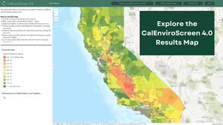
Why use this map? CalEnviroScreen includes an online mapping tool, a supplemental race analysis and related documents. It analyzes data on environmental, public health and socioeconomic conditions in California’s 8,000 census tracts to provide a clear picture of cumulative pollution burdens and vulnerabilities in communities throughout the state.
Created and maintained by: State of California, Office of Environmental Health Hazard Assessment (OEHHA)
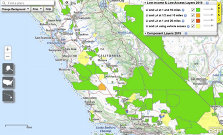
California Climate Investments Priority Populations
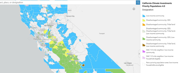
Why use this map? 35% of California Climate Investments must be allocated to disadvantaged communities, low-income communities and low-Income households, collectively referred to as priority populations. This map shows disadvantaged communities and low-income communities as defined for California Climate Investments.
Created and maintained by: State of California, Air Resource Board (CARB)
Healthy Places Index
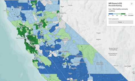
Why use this map? Evidence-based and peer-reviewed, the HPI supports efforts to prioritize equitable community investments, develop critical programs and policies across the state, and much more.
Created and maintained by: Public Health Alliance of Southern California
Food Systems
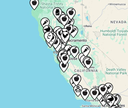
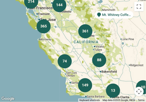
California Cafeterias (Farm to School)

Why use this map? Wondering which public school districts source local food and which food hubs deliver to them? Find where they are and how to contact folks to start a new partnership.
Created and maintained by: CDFA, Office of Farm to Fork
California Farm Directory
Why use this map? Find a California farmer near you, learn what and what they’re selling.
Created and maintained by: California Alliance with Family Farmers (CAFF)
CCOF Organic Directory
Why use this map? Find over 3,000 CCOF certified members in California including farmers, ranchers, food businesses, retailers, and distributors.
Created and maintained by: California Certified Organic Farmers (CCOF)
Farmers’ Market Finder

Why use this map? Shop at your local farmers’ market! Find a farmers’ markets in your area and whether they accept CalFresh EBT, WIC, Market Match, and other programs.
Created and maintained by: The Ecology Center
Food Access / “Food Deserts”
Why use this map? Offers census-tract-level data on food access.
Created and maintained by: US Department of Food and Agriculture
Food and Agriculture Mapper and Explorer
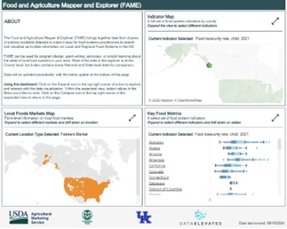
Why use this map? Explore and visualize recent information on local and regional food systems in the US. Can be used for program design, grant writing, advocacy, or learning about local food systems in your area.
Created and maintained by: USDA and Colorado State University
Food Hubs
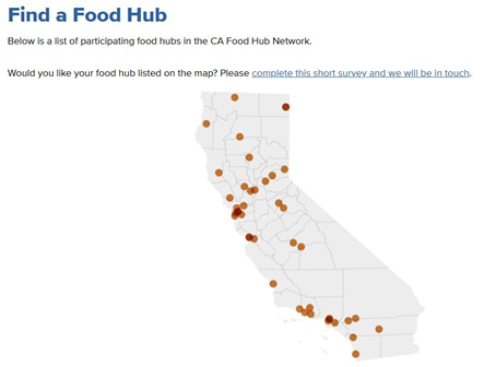
Why use this map? Looking for a food hub in California? Find their locations and contact information.
Created and maintained by: UC Sustainable Agriculture Education and Research Program (UC SAREP)